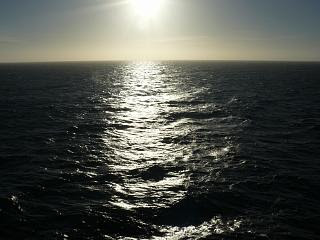
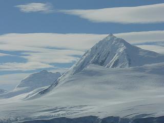
 We are now well into our exciting and eagerly anticipated Antarctic Exper-ience and are cruising further southwards towards an area that covers 9% of the earth's surface.
The distance covered since we left Cape Horn yesterday morning and moved south through the Drake Passage will have been close to 600 miles by the time we hit Palmer Station sometime after noon today.
The bright sunlight that crept in through the crack in the curtains (drapes) of our balcony window indicated another remarkable day awaited us.

Were we really in the Antarctic?
A visit to the aft deck outside the Lido restaurant quickly confirmed that we were certainly in the Antarctic. 

For many years these had served us well in the often cold, wet and windy North Sea that separates the UK from the Northern parts of continental Europe. 
The one word that echoed round the quite busy Lido restaurant was ‘icebergs’.
One had been spotted in the far distance and binoculars and camera zoom lenses were eagerly searching the horizons. 
Thoughts of the Titanic were probably not far from many minds. Anyway why worry didn’t someone say that the Prinsendam was unsinkable?
Maria was easily persuaded to give up the comfort of her warm bed and join me around the ship, camera in hand searching for what, we were not quite sure.
Our next land sighting was not expected until 1 o'clock. The Captain had just announced that because of unexpected head winds the ships schedule had been put back an hour.
In the wind it was bitter. And I do mean bitter, even with the layers of clothes protecting our bodies. Out of the wind it seemed relatively warm in comparison.

We enjoyed the freedom of the ship as we wandered around. Maria even thought of doing a little Antarctic sunbathing, without the bikini of course!


 Almost 98% of this mass is solid ice and was finally considered a continent in 1840 and not just a group of isolated islands. Today it has active territorial claims submitted by Argentina, Australia, Chile, France, New Zealand, Norway and the United Kingdom. Many of these claims are not recognized by some countries and remain in a constant disputed status.
It of course has no capital city and is the coldest and windiest spot on the planet. In fact, the lowest temperature ever recorded on earth was recorded in Antarctica (-129.3ºF) and the mean winter temperatures range from -40º to -94ºF. Winds are commonly measured at up to 200 miles per hour.
Our first sight of the real Antarctica will be Anvers Island (also known as Antwerp Island or Antwerpen Island or Isla Amberes), it is a high mountainous island 38 miles long, which is the largest feature in the Palmer Archipelago, lying south west of Brabant Island at the south western end of the group.
The Island is located at 64°33′S 63°35′W / 64.55°S 63.58°W / -64.55; -63.58. Named in 1898 by the Belgian Antarctic Expedition under Adrien de Gerlache after the Belgium city of Antwerp. The Island however was firstly discovered by Captain John Biscoe who, in thinking that it was the mainland, claimed it for Great Britain in 1832.
Anvers Island is the largest and the southernmost island of the Palmer Archipelago. The United States Antarctic Program maintains Palmer Station at the southern end of the island. The Station is named after Nathaniel Palmer, who sailed his 50 foot ship Hero from South Georgia to the Antarctic Peninsula in search of new sealing grounds. Palmer, however, never visited Anvers Island but is likely to have been one of the first three persons to see Antarctica.
The Palmer Station (see library photo below) on Anvers Island is located at (64°46′S 64°03′W / 64.77°S 64.05°W / -64.77; -64.05) and is Antarctica's only U.S. station north of the Antarctic Circle. Construction finished in  1968. Around 50 people can inhabit Palmer Station at one time. There are science labs in the station as well as a dock.
The station hut of the British Antarctic Survey was loaned to the U.S. Government in July 1963 and was converted into a biological laboratory in January 1965 for use by American scientists at the nearby Palmer Station. However the station was destroyed by fire on December 28, 1971 while being renovated by the British. Debris was removed by the members of the US Antarctic Program in 1990/1991 and now only concrete foundations remain.
At shortly before noon one of our Exploration Lecture Team, John, announced over the ship’s PA system (also right into our cabin on good old Channel 43) that in the haze ahead Anvers Island could now just be seen.

Over the next 30 minutes or so we gradually closed in on this the first sight we have had of the true Antarctic. 
The snow and ice covered land masses just appearing out of the arctic sea really are the most amazing sights. 

We were now in and out of the balcony, alternating between it and the much warmer cabin with its 42inch flat screen TV showing what was lying ahead of us.


For the next hours the ship leisurely cruised round the Island and its associated Archipelago, enabling us all to take a continuous range of photographs that we would treasure for ever. This was country of unbelievable virgin beauty.
Lemaire Channel is a strait off Antarctica, located between the mainland's Antarctic Peninsula and Booth Island. Nicknamed "Kodak Gap" by some, it is one of the top tourist destinations in Antarctica; steep cliffs hem in the iceberg-filled passage, which is 7 miles long and just 1 mile wide at its narrowest point.
It was first seen by the German expedition of 1873-74 but not traversed until December 1898, when the 'Belgica' of the de Gerlache expedition passed through. De Gerlache named it for Charles Lemaire, a Belgian explorer of the Congo.
Glaciers and cliffs are reflected in still waters at the south end of the channel. The Channel has since become a standard part of the itinerary for cruising in Antarctica; not only is it scenic, but the protected waters are usually as still as a lake, a rare occurrence in the storm-wracked southern seas. The principal difficulty is that icebergs may fill the channel, especially in early season, obliging a ship to backtrack and go around the outside of Booth Island in order to reach Petermann.

It would appear that the photo opportunities here are even more spectacular than on Avers Island that we had visited just an hour or so earlier, if that was possible. So this was ‘Kodak Gap’ and even this iconic name didn’t do justice to it.

The scenery was awe-inspiring and must surely be the pinnacle of our experiences down here in Antarctica? Only time will tell.
Again our camera was red-hot from both Maria and I snapping away at something we still couldn’t quite comprehend yet, this whole Antarctica Experience.


Françoise had previously told me that the ship turns a blind eye on these occasions to crew members mingling with passengers all seeking a great photo opportunity.
I’m sure there is not a passenger on board that in any way would object to these hard working dedicated crew having their moments too.

That will have to be it for today but we are still passing the most incredible views you can imagine in this completely unspoilt wonderful part of the world. If you ever get the chance make sure you get down here. We will continue today later in part 2.

Incredibly beautiful photographs and a wonderful commentary to go with them. Thank you again for sharing this amazing experience.
ReplyDeletePaul and Maria,
ReplyDeleteYour photos are wonderful. I am so glad that you are having fantastic weather whilst you are doing in Antarctica. It makes such a difference to the photos and how you view this incredible part of the world we live in.
Jennie